日本語
Guide to viewpoints in Nagasaki Prefecture
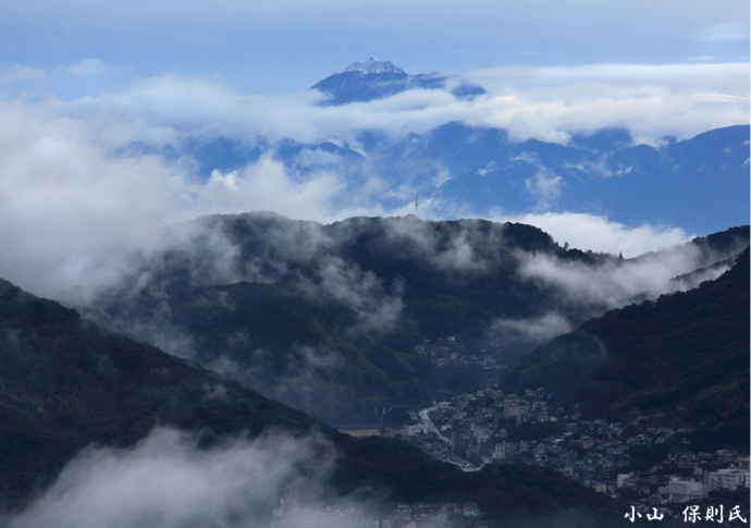
 From the summit observatory of Inasa-yama in Nagasaki City
Let's click the map for the guide of viewpoints in the prefecture!
If you click the area/transport names below the map,
you can check the views from the respective areas/transports
(in Japanese with English titles).
①長崎市 Nagasaki City ②諫早市 Isahaya City ③大村市 Omura City
④西海市 Saikai City ⑤佐世保市 Sasebo City
⑥島原半島地域 Shimabara Peninsula Region ⑦ JR長崎本線 JR Nagasaki Line
⑧島原鉄道 Shimabara Railway ⑨島鉄バス Shimatetsu Bus
⑩長崎空港 Nagasaki Airport ⑪苓北観光汽船 Reihoku Kanko Kisen
⑫有明フェリー Ariake Ferry
⑬三池島原ライン Miike-Shimabara Line (high-speed vessel)
⑭九商フェリー Kyusho Ferry ⑮熊本フェリー Kumamoto Ferry
⑯島鉄フェリー Shimatetsu Ferry ⑰長崎ロープウェイ Nagasaki Ropeway
⑱雲仙ロープウェイ Unzen Ropeway
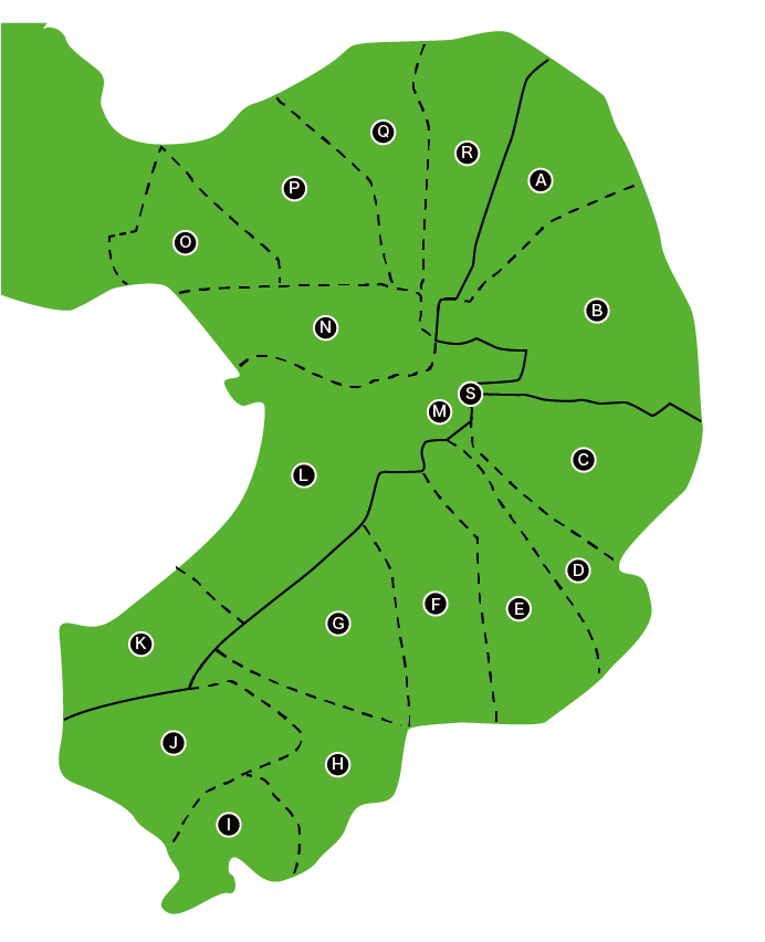
Let's click the map for the guide of viewpoints in Shimabara Peninsula!
If you click the area/transport names below the map, you can check the views
from the respective areas/transports (in Japanese with English titles).
A 島原市-有明エリア Shimabara City-Ariake Area
B -島原エリア -Shimabara Area
C 南島原市-深江エリア Minamishimabara City-Fukae Area
D -布津エリア -Futsu Area
E -有家エリア -Arie Area
F -西有家エリア -Nishiarie Area
G -北有馬エリア -Kitaarima Area
H -南有馬エリア -Minamiarima Area
I -口之津エリア -Kuchinotsu Area
J -加津佐エリア -Kazusa Area
K 雲仙市-南串山エリア Unzen City-Minamikushiyama Area
L -小浜エリア(小浜温泉) -Obama Area (Obama Onsen)
M -小浜エリア(雲仙温泉) -Obama Area (Unzen Onsen)
N -千々石エリア -Chijiwa Area
O -愛野エリア -Aino Area
P -吾妻エリア -Azuma Area
Q -瑞穂エリア -Mizuho Area
R -国見エリア -Kunimi Area
S 雲仙岳山上部 Top Area of Mt.Unzen

