


日本語

●Names and origins of Mt.Unzen
Mt.Unzen is collective name for more than 20 component mountains towering in the center of Shimabara Peninsula (SE part of Nagasaki Prefecture). It was originally called "Onsen-zan" meaning a mountain with hot spring outwelling, and the name has varied across the ages from "Onsen-zan" through "Unzen-zan" to "Unzen-dake", the present name in Japanese.
The mountain is called "Unzen-kazan (Unzen Volcano)" in volcanology, and it includes all the component mountains from eastern Mayu-yama to western Saruba-yama. The component mountains amount to more than 30 including ones not on the modern map, and the complicated figure of Mt.Unzen has been expressed by various numbers like San-gaku-go-hou (3+5 mountains), Hachi-you (8 mountains), Nijushi-hou (24 mountains), Sanjuro-ppou (36 mountains), and so on (Ref. 1, in Japanese with English titles).
Mt.Unzen started activities as a submarine volcano in ca. 500 thousand years ago, and then repeated eruptions producing land areas forming a volcanic island, and finally formed Shimabara Peninsula connecting the island to north mainland (Kyushu Island) in ca. 400 thousand years ago (Ref. 2).
●Location and figure of Mt.Unzen
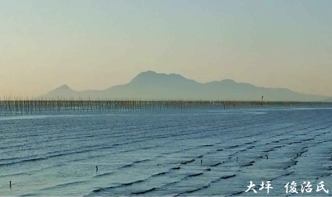
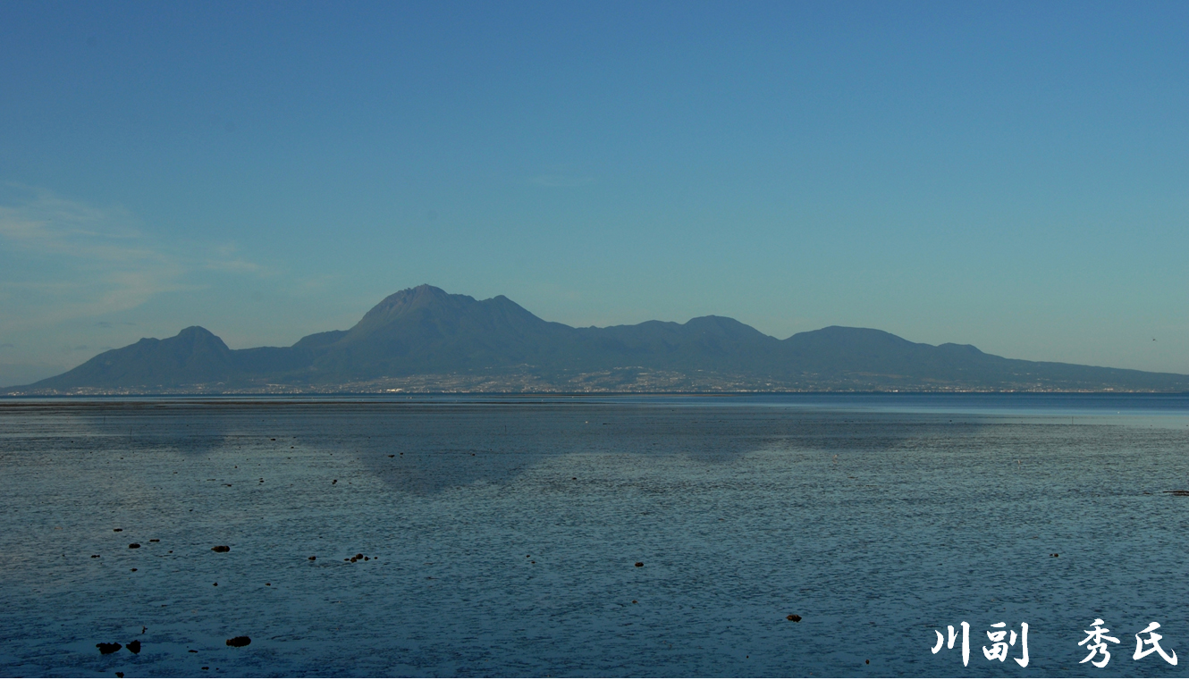
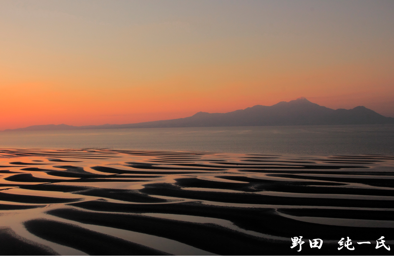
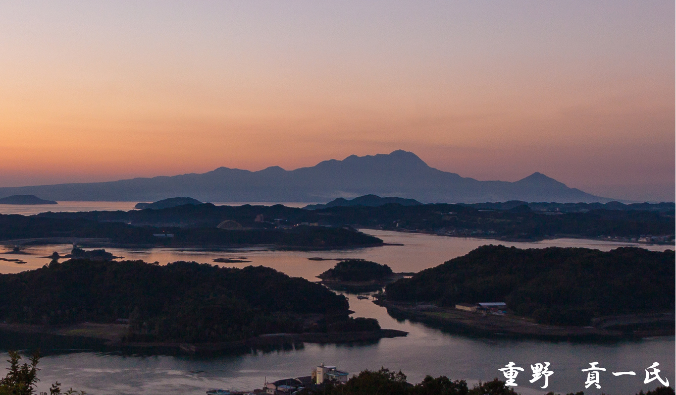
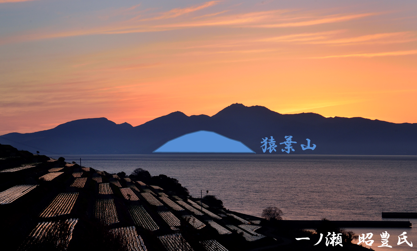
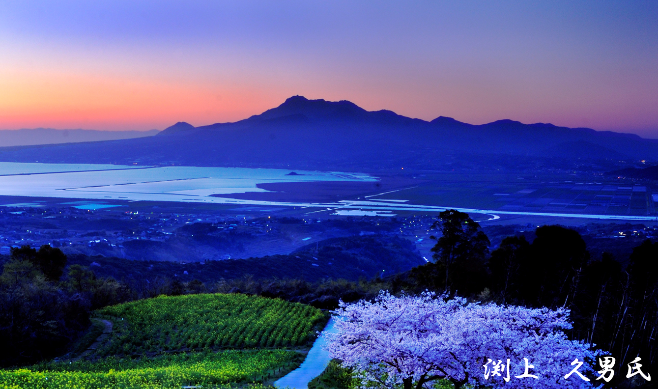
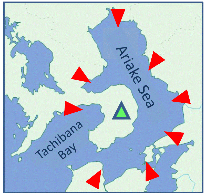 As Mt.Unzen is surrounded by Ariake Sea and Tachibana Bay on three sides, we can enjoy viewing the entire mountain's figure floating on the seas from 360-degree directions. The mountain shows different figures for respective directions because of comprising many component mountains, and can be expressed as roughly 4 types (faces), and precisely 8 types (faces) according to compass directions.
Although the figure of the mountain is compared to various things like the lying Goddess of Kannon or a sleeping pregnant female, here we will introduce the 4/8 faces of the mountain comparing to "a turtle bearing carapace".
【North face】 A turtle heading to the left with its neck stretched. Its head for Mayu-yama, and its carapace top for Heisei-shinzan (the highest component mountain).
【Northeast face】 The turtle getting a larger head with two horns and a shorter neck.
【East face】 The turtle heading to this side spreading its forefeet, and looking like almost bilaterally symmetric.
【Southeast face】 The turtle heading to the right with its neck stretched a little with two horns.
【South face】 The turtle with a one-horned head and a longer neck.
【Southwest face】 The turtle getting a two-horned head and a shorter neck which can be overlooked beyond its right forefoot.
【West face】 The turtle heading to the other side making its tail (Saruba-yama) visible, and looking like bilaterally asymmetric (the left side terraced).
【Northwest face】 The turtle getting a one-horned head (Mayu-yama) which can be overlooked beyond its left forefoot.
●Landscapes of Mt.Unzen
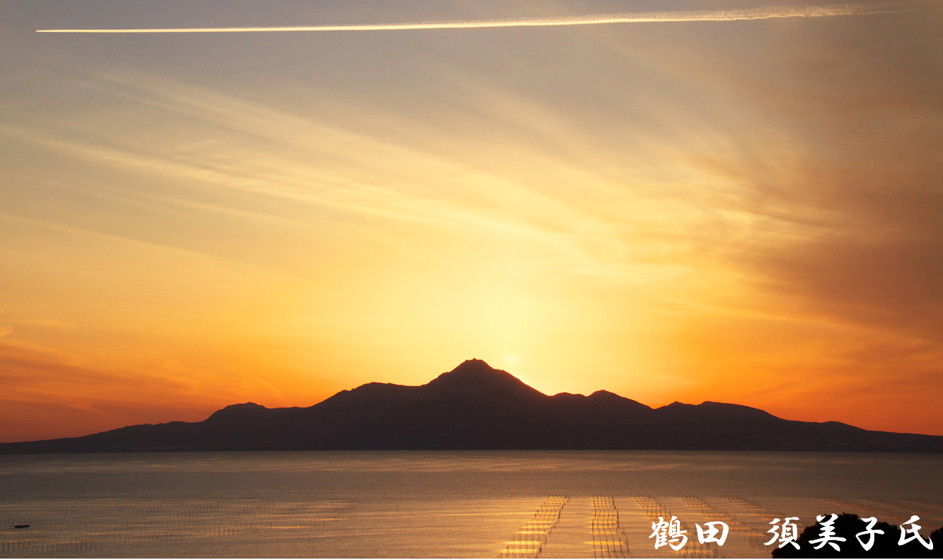
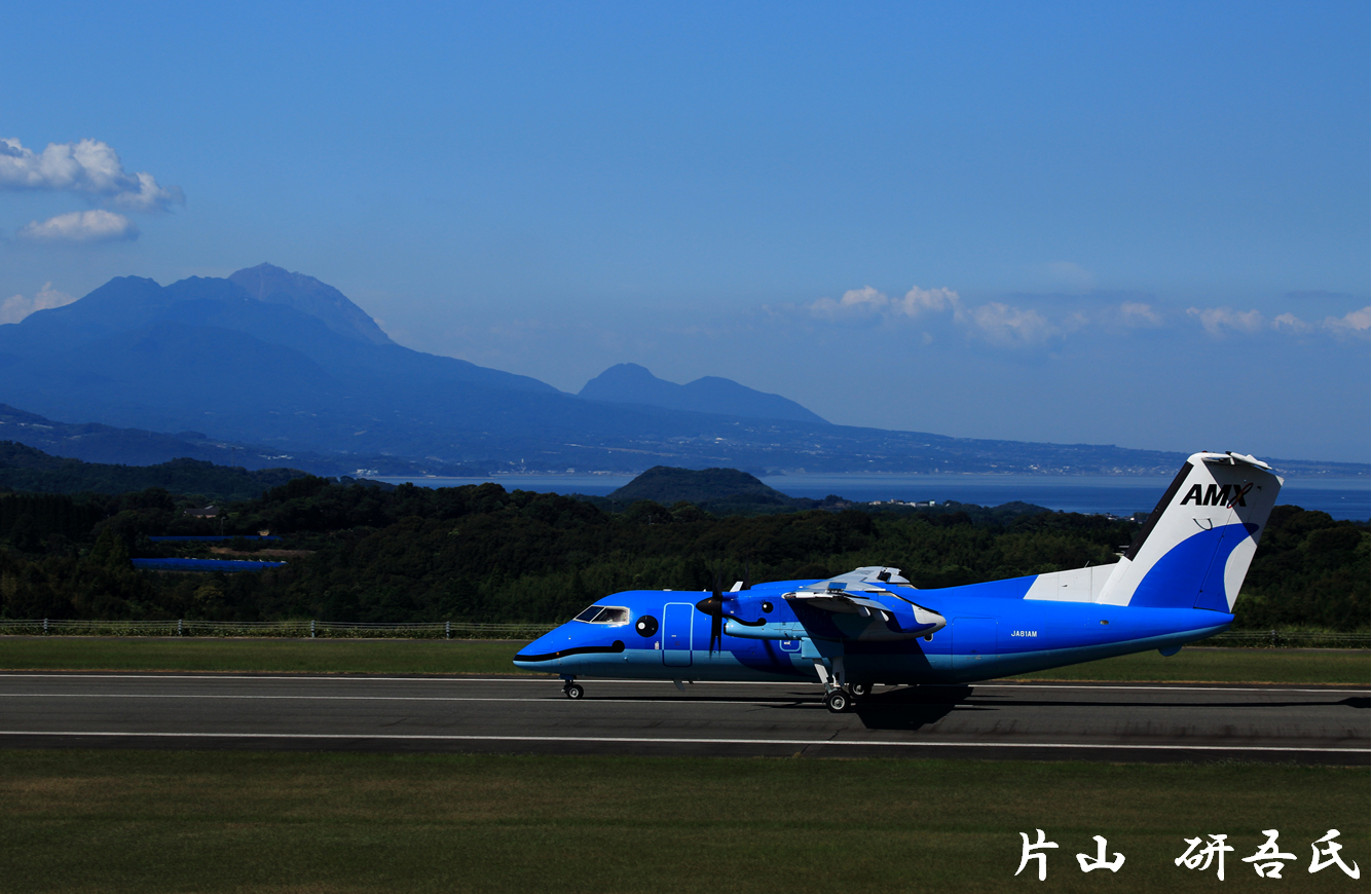
Mt.Unzen, surrounded by the seas on three sides, was highly appreciated for "the terraqueous panorama", and was designated the first national park of Japan (in March 1934; now Unzen-Amakusa National Park) as being "the center of the land/sea round-trip system of West Kyushu". The views of mountain from sea and the views of sea from mountain are both dynamic panoramas (Ref. 3). Furthermore, the mountain delights travelers with various seasonal colorations (Ref. 4).
Focusing on such blessing of the volcanic activities of Mt.Unzen as well as threatening of them, Shimabara Peninsula was approved as the first global geopark of Japan (in August 2009; Unzen Volcanic Area Geopark), where visitors can enjoy learning about "coexistence of people and active volcano" travelling the peninsula (Ref. 5).