Four regions of the World Natural Heritage
*PDF files and external links will open in a new window (separate tab).
Amami-Oshima Island
Amami Ōshima Registration Area Map(PDF:324KB)
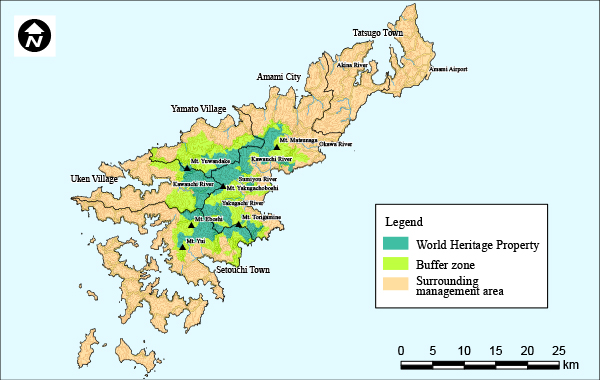
The central and southern regions of Amami Ōshima are distinguished by a continuous stretch of lush subtropical evergreen forests, extending from mountains like Mt. Yuwandake (694m) and Mt. Yuidake (484m) to the coastal areas. These forests are crucial habitats for both relict species, including the Amami rabbit, the Ryukyu long-haired rat, and the Amami jay, as well as endemic species such as the Amami spiny rat and the Otton frog. Mt. Yuwandake, the island's highest peak, forms a unique cloud and mist zone characterised by high aerial humidity and limited sunlight. This environment supports the growth of rare epiphytes like Liparis viridiflora on trees and Pteridophytes to thrive on the forest floors.
Tokunoshima Island
Tokunoshima Registration Area Map(PDF:266KB)
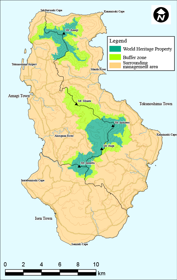
In Tokunoshima, lush subtropical evergreen forests, dominated by Castanopsis sieboldii trees, stretch from the northern peak of Mt. Amagidake (533m) and the central Mt. Inokawadake (645m) to Mt. Inutabudake (417m). This region supports the growth of Quercus miyagii, an oak species native to the Ryukyu Islands, known for its distinctive buttress roots. The island is also home to unique wildlife, including relict species like the Amami rabbit and the Ryukyu long-haired rat, as well as endemic species such as the Banded ground gecko and Tokunoshima spiny rats , which are exclusive to Tokunoshima. Additionally, the area provides a habitat for rare and endemic plants like Arisaema kawashimae and Asarum hatsushimae.
Northern Part of Okinawa Island
Northern Okinawa Island Registration Area(PDF:335KB)
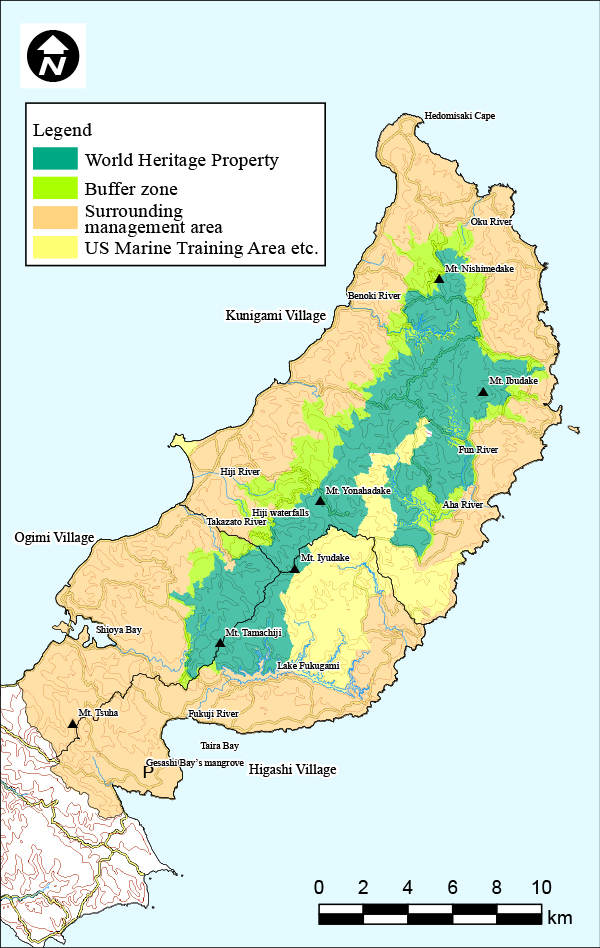
In the northern part of Okinawa so called, Yanbaru region around Mt. Yonahadake (503m) and Mt. Nishimedake (420m), there are lush subtropical evergreen forests primarily composed of Castanopsis sieboldii trees. These forests are home to many rare and endemic plants and animals found only in this area, including the Okinawa spiny rat, Okinawa Ishikawa’s frog, Okinawa rail, Okinawa woodpecker, Cheirotonus jambar, and the Dendrobium okinawense. The region is also known for its distinctive stream vegetation. Plants here have adapted to the unique conditions of the mountain streams, changing their shapes to survive the cycles of flooding and water level changes.
Iriomote Island
Iriomote Island Registration Area Map(PDF:285KB)
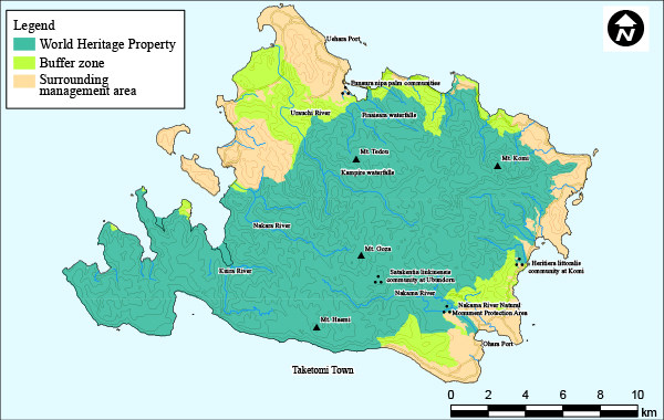
The central area of Iriomote Island is distinguished by a chain of mountains, including Mt. Komidake (469m) and Mt. Gozadake (420m), surrounded by pristine subtropical evergreen forests. The island's landscape is marked by a rich and varied ecosystem comprising rivers, mangrove forests, wetlands, and mudflats, notably including the Urauchi and Nakara Rivers, creating continuous watersheds from the mountains to the sea. Iriomote highlights the island's distinctive evolutionary path compared to the other three regions of the Nakaryukyu, due to the separation from the mainland. It is the host of new endemic species like the Iriomote cat, the Yellow-margined box turtle, and the Utsunomiya’s tip-nosed frog.